In response to a growing need for transboundary groundwater information, SADC, with support from International Cooperating Partners, has developed a SADC Hydrogeological Map. The map was developed as part of the Regional Groundwater Management Programme in the Regional Strategic Action Plan for Integrated Water Resources Development and Management (RSAP-IWRM) (SADC 2009).
This map is intended to provide information on generalised hydrogeological characteristics for the entire SADC region, focusing on the extent and geometry of regional aquifer systems. The map is designed to be a tool for hydrogeologists and water resource planners, and non-specialists alike (SADC 2009).
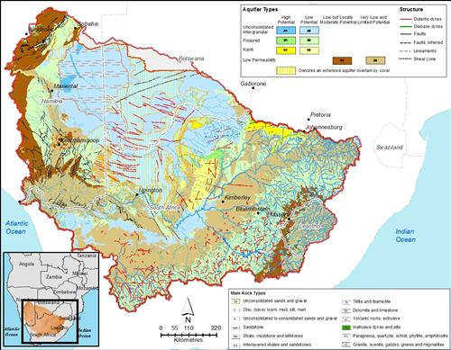
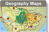
SADC Hydrogeological Map for the Orange-Senqu River basin.
Source:SADC 2010
( click to enlarge )
Furthermore, the map is available through an internet portal as an interactive web-map application at: An explanatory brochure and the Hydrogeological Mapping Procedures, Standards and Guidelines report are available in the Document Library.
Development of the Hydrological Map
The team that developed the map used the SADC Geology Map (unpublished) as a base for illustrating lithographic distribution across the region. The 730 lithostratigraphic units were simplified to 29 classes relevant to hydrogeology:
-
Unconsolidated sands and gravel
-
Clay, clayey loam, mud, silt, marl
-
Unconsolidated to consolidated sand, gravel, arenites, locally calcrete, bioclastites
-
Sandstone
-
Shale, mudstone and siltstone
-
Interlayered shales and sandstone
-
Tillite and diamictite
-
Dolomite and limestone
-
Volcanic rocks, extrusive and intrusive dykes and sills
-
Paragneiss, quartzite, schist, phyllite, amphibolite
-
Granite, syenite, gabbro, gneiss and migmatites
Aquifer types were defined based on groundwater flow characteristics from the above lithological classes:
-
Unconsolidated intergranular aquifers
-
Fissured aquifers
-
Karst aquifers
-
Layered aquifers
-
Low permeability formations
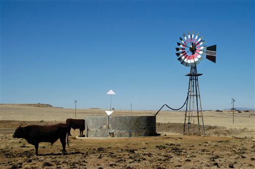
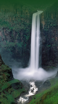
Groundwater is an essential source of water for agriculture, including livestock.
Source:Vogel 2009
( click to enlarge )
Transboundary Aquifer Systems
In addition to mapping standard hydrogeological characteristics of the SADC region, the project also refined a set of agreed transboundary aquifers in the region. Although the natural extent of these aquifers still need to be verified, these data are extremely useful in the context of transboundary water resources management. The transboundary aquifers are listed in the table below.
Transboundary Aquifers in the SADC Region
|
Name |
States |
|
Karoo Sandstone Aquifer |
Tanzania, Mozambique |
|
Tuli Karoo Sub-basin |
Botswana, South Africa, Zimbabwe |
|
Ramotswa Dolomite Basin |
Botswana, South Africa |
|
Cuvelai and Ethosha |
Angola, Namibia |
|
Coastal Sedimentary Basin |
Tanzania, Mozambique |
|
Shire Valley Aquifer |
Malawi, Mozambique |
|
Congo Intra-cratonic Basin |
D R Congo, Angola |
|
Coastal Sedimentary Basin |
D R Congo, Angola |
|
Coastal Sedimentary Basin |
Mozambique, South Africa |
|
Medium Zambezi Aquifer |
Zambia and Zimbabwe |
|
Dolomitic |
D R Congo, Angola |
|
Sands and gravel aquifer |
Malawi, Zambia |
|
Kalahari/Karoo Basin |
Botswana, Namibia, South Africa |
|
Eastern Kalahari/Karoo Basin |
Botswana and Zimbabwe |