The World Wildlife Fund for Nature (WWF) has, over the past 10 years, been leading efforts to identify, describe, classify and map the ecology of planet Earth. These efforts have lead to the development of geographic mapping concepts known as biomes and ecoregions. These concepts are defined below and their distributions across the Orange-Senqu River basin described.
Biomes
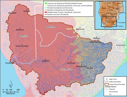
Biomes are climatically and geographically distinct regions defined on a larger and more general scale than ecoregions. In the Orange-Senqu River basin the principle biomes are deserts and xeric shrublands with montane grasslands and shrubs in the higher elevations to the east.
The map below shows the distribution of biomes across the Orange-Senqu River basin

Terrestrial Biomes of the Orange-Senqu River basin.
Source:Hatfield 2009, after WWF 2004
( click to enlarge )
Ecoregions
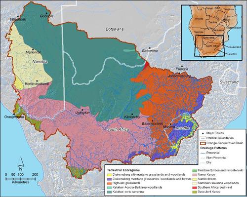
Ecoregions are defined as units of land or water containing a geographically distinct assemblage of species, natural communities, and environmental conditions" (WWF 2010b). Therefore, ecoregions help us understand the nature and make up of species, communities and ecosystems.
While ecoregions have been mapped (see below), the boundaries of these regions should not be considered as rigid. The map below shows the distribution of terrestrial ecoregions for the Orange-Senqu River basin.

Terrestrial Ecoregions of the Orange-Senqu River basin.
Source:Hatfield 2009, after WWF 2004.
( click to enlarge )
