Information Systems are essential for the efficient management of water resources, as they can allow for quick and easy access to data as well as providing for data quality control.
Botswana
The Department of Geological Survey (DGS) has maintained a MS-DOS-based National Borehole Archive (NBA), which unfortunately does not support multiple-users, constraining its use within the department. A copy of the archive is maintained at the Department of Water Affairs (DWA).
The NBA was populated with data recorded on Borehole Completion Certificates (BCC). In 2002, a new hydrogeological database (GeoDin) was launched, but it contained only the little data that was available to be transferred from the old NBA. Though it was intended that all the BCCs would be entered into the system, there remains a huge backlog of data to be analysed.
DWA maintains separate databases as a response to the limitations of the existing database arrangements. WELLMON is a software package for groundwater monitoring data, climatic data and other parameters, used to produce groundwater hydrographs. Currently, WELLMON contains only groundwater level and abstraction data.
Water Quality Database
The Water Quality Database contains water quality analyses of surface water and groundwater. This database unfortunately does not contain detailed positional data, again limiting its usefulness.
Lesotho
Digital and Hardcopy Data
Groundwater datasets, reports and maps are available in hard copy from the Department of Water Affairs (DWA) in Maseru and through the Lesotho Water Sector Information Management System (LWSIMS).
LWSIMS is a European Commission-funded project designed to help the Lesotho Water Sector plan towards achieving the Millennium Development Goals associated with water. The system is intended for users to develop databases and share them to avoid duplication. Government departments can maintain independent and confidential databases, and still allow the public access to enough information to keep them informed.
Documents on water-related policy and regulations are available on the LWSIMS site (http://www.lwsims.gov.ls/Pages/RequestAccess.aspx) and requests for data can be submitted directly through the site. Data available in digital format include:
-
Administrative boundaries
-
Climatology (rain gauges and weather stations)
-
Community facilities (health, etc.)
-
Wetland Areas
-
Hydrology (dams, flow gauges, etc.)
-
Landcover
-
Topography
-
Transportation
On the LWSIMS site a "map viewer" allows readers to overlay the selected information on a map of Lesotho.
Namibia
Hardcopy Data
There are about 40 000 hardcopy records of Borehole Completion Forms of WW-numbered (specifies location) boreholes. These capture farm name and number (the most consistent way to locate land information in Namibia), borehole depth, depth of water strikes and associated yields, lithology and borehole casing material, and for more recently drilled boreholes, GPS location. The Department of Water Affairs (DWA) is custodian of these data sets.
Some 90 000 water chemical analyses of major ions, plus some bacteriological data, are also available. In addition, about 30 000 groundwater samples were analysed by the Council for Scientific and Industrial Research (CSIR, South Africa) during the CSIR Water Quality Project between 1965 and 1981.
In addition, NamWater reports monthly on production borehole utilisation rates.
Electronic Data
There is a relatively complete set of data on the more important parameters for boreholes drilled before 1990. Changing database platforms, coupled with the development of these databases and a lack of resources and capacity, has led to a substantial backlog in the unification of these datasets. A new database (GROWAS) became operational towards the end of 2004. Most rainfall data and surface water abstraction information (dams) is available in an electronic format.
Groundwater and Surface Water Abstraction
Under the Water Act of 1956, permits for large-scale groundwater abstraction are required only in Groundwater Control Areas of Namibia. In the Orange-Senqu River basin these include the Windhoek–Gobabis areas, the Stampriet Artesian Basin and the Maltahöhe artesian area. There are 13 permit holders on the Lower Orange River, allocated a total annual abstraction of some 45 Mm3 (ORASECOM 2007d).
Listen to a radio segment on the importance of Groundwater in Namibia
 Information systems allow data to be made easily accessible and transferable. Source:©iStockphoto/Parnell 2007 ( click to enlarge ) |
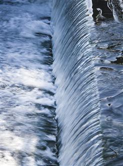 Stream-flow, as well as chemical and physical water attributes, are monitored for the entire basin and compiled in comprehensive information systems. Source:©iStockphoto/Kawisign 2008 ( click to enlarge ) |
South Africa
National Groundwater Information System (NGIS)
The National Groundwater Information System (NGIS) is a series of Department of Water Affairs (DWA) projects at regional offices, designed to meet the increasing demands for groundwater information. The NGIS system includes both spatial and non-spatial data, as well as tools for visualisation and analysis. Several sub-applications are detailed in the box below.
Box: National Groundwater Information Systems
To access any of the following data sets, please contact
georequests@dwaf.gov.za.
-
The National Groundwater Archive (NGA)
The NGA is a web-based system that allows registered users to capture, view, modify and extract groundwater-related data. Currently it focuses on data related to boreholes, wells, springs, and other geosites (points associated with geohydrological information). The NGA will replace the existing Open National Groundwater Database (Open NGDB).
Open NGDB is a system designed as a transition from the previous National
Groundwater Data Bank (NGDB). This is presently the national database system for managing
groundwater data and is accessible to trained users. It is available in the National Office and all Regional offices, although not all these offices are actively capturing
groundwater data. Currently there are about
242 000 records in the Open-NGDB. This data can be obtained from DWA South Africa offices.
The Regional Geohydrological Information System is a complete hydrogeological information system, in which all relevant hydrogeological and related data are stored, managed, manipulated and queried. REGIS-Africa can be used for the evaluation of geohydrological situations on a national and regional scale.
The (C)Hydro Geochemical Analysis and Reporting Tool is a combination of the Management Information System and Decision-Support System which integrates geohydrological and hydro-chemical data to establish more effective and efficient monitoring.
-
Geohydrological Report System
The Geohydrological Reports System is a database of groundwater related technical reports. Approximately 2 600 technical reports are available in the library at DWA South Africa head-offices in Pretoria. These reports reflect the many hydrogeological investigations done by DWA South Africa officials or consultants over the years. A web-based system allows users to inquire about the availability of specific documents and obtain access to the documents in digital format (PDF). Other groundwater related documents and 1:500 000 Hydrogeological maps and brochures are also available on request.
The Geodatabase is an ARCGIS GEODATABASE storing all validated and verified spatial hydrogeological data. This database feeds into other applications, such as the REGIS-Africa.
Source: DWAF 2009
Water Management System (WMS)
The Water Management System was first initiated in 1996 by DWA South Africa to support decision-making and to provide the information needed to monitor and manage water resources in South Africa. To obtain data from the WMS contact: wms@dwaf.gov.za
The WMS comprises three essential components:
-
Monitoring Management Subsystem - manages resource quality operational monitoring at a national scale
-
Water Resource Management Subsystem - for sustainable water use, the protection of water quality, source control and for exporting Water Quality Data from the WMS to other systems
-
GIS subsystem - displays Water Resource information in a geographic viewer.
The system has the following functionality:
-
Monitoring
-
Water Quality Assessment
-
Water Quality Catchment and Resource Management
-
Point Source Management
-
Non-Point Source Management
-
Water Quality Education and Awareness
-
Best Water Quality Practices and Technology
Water quality data for both surface water and groundwater are collected at a regional level and entered into the WMS. The parameters analysed include:
-
Trace metals (Zn, Pb, Cu, etc.)
-
Inorganic (TDS, EC, Calcium dissolved, Na dissolved, Phospate, etc.)
-
Biological (Faecal coliform, suspended solids, algal identification, BOD5, etc.)
-
Organic pollutants (atrazine, terbuthylazine, methomyl, etc.)
Hydstra
In addition to chemical water quality parameters, physical water parameters are collected through the Hydstra project to better monitor the overall health of the aquatic system. Hydstra is a database managed by DWA South Africa, with its primary function being the management of long time-series data, including:
-
Dam water levels
-
Evaporation and rainfall
-
Streamflow (discharge)