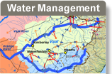
Although surface water delivered through large transfer schemes and dams is an important source of fresh water in the Orange-Senqu Riverbasin, the arid regions of the basin (Botswana, Namibia and western parts of South Africa) are highly dependent on groundwater and the small-scale supply of surface water. In southern Botswana, groundwater is the main source of water for the majority of the human and livestock populations. Much of Namibia, and many rural communities in South Africa, also depend heavily on groundwater. Small-scale water supply schemes are predominantly limited to the rural parts of the Orange-Senqu Riverbasin that have limited access to the network of municipal water supplies.
Box 1: Importance of Hydrogeological Mapping for Groundwater in Rural Areas
Rural areas, particularly in remote parts of the Orange-Senqu Riverbasin, are often logistically difficult to supply with surface water – too far from rivers and reservoirs and in arid environments where exposed surface water evaporates quickly. Many rural communities therefore depend on groundwater. As a result, understanding of groundwater in southern Africa is highly developed—many academic institutions focus on groundwater studies, and the national government allocates significant resources to groundwater exploration, monitoring and protection.
However, even though understanding of the groundwater environment is good, the complexities of mapping groundwater occurrence has meant that few hydrogeological maps have been created. The audio segment below provides an insight into the benefits of the development of hydrogeological maps. The subject, a farmer from Gobabis, has had to move to Windhoek to find work, as there is not enough water to run the farm in his home town.
Quantifying groundwater in the course of developing a hydrogeological map for Namibia should make it possible to understand exactly how much groundwater exists in rural areas, such as Gobabis.
Source: Moses Magadza,Southern Africa Water Wire, 2009.
In the arid parts of South Africa and Namibia, abundant high-quality groundwater is mostly confined to areas underlain by dolomitic rocks. Aquifers beneath much of the remaining arid lands in the basin are often unsuitable as water sources:
Water is only found at great depth and in low yielding aquifers, making it inefficient and expensive to extract
Water is often brackish, containing dissolved salts in excess of 350 mg/L and sometimes above 3 000 mg/L, making it unsafe for consumption
Groundwater from some geological formations can naturally contain fluoride levels too high for normal bone and tooth development
In areas of high human density and inadequate sanitation, groundwater may be polluted by nitrates or faecal pathogens
Groundwater close to or areas with poor sanitation and beneath areas of intensive agricultural development may also contain high levels of nitrates, which if above 40 mg/L, can be harmful to human and livestock health. Nitrate in water can be particularly harmful to bottle-fed infants and expecting mothers and cattle. (Water Research Commission 2005).
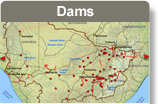
To see a map of borehole density in the Orange-Senqu Riverbasin, please refer to the Groundwater section of the River Basin theme.
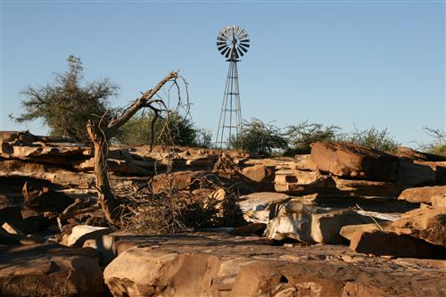
A windpump in southern Africa, a common sight in a region dependent on groundwater.
Source:Kirchner 2008
( click to enlarge )
Box 2: International Shared Aquifers (Kalahari/Karoo Multi-layered Aquifer)
The Kalahari/Karoo Multi-Layered aquifer is shared by Namibia (Stampriet Artesian Basin), Botswana (South Western Karoo Basin) and South Africa (Western Kalahari aquifer). Most of the water extracted from the aquifer is in Namibia, where most of the recharge also appears to occur. The aquifer is key to future human and economic development in the arid environment of the Kalahari.
Botswana
The Lebung and Ecca Groups of the Karoo Supergroup are considered to be the main water bearing layers of the Botswana South Western Karoo Basin. Investigations conducted in Botswana indicate that the aquifers are mainly recharged in Namibia with groundwater flowing eastward. Certain boreholes drilled into this aquifer exhibit high nitrate concentrations.
Namibia
Extensive studies have been conducted in the Stampriet Artesian Basin in Namibia. Water occurs mainly in the Auob and Nossob sandstones of the Ecca Group, as well as in the overlying Kalahari. Water quality in this aquifer has been found to decrease in a south-easterly direction. The water quality of the Karoo aquifers appears to be locally very poor, in the so called “Salt block”, which is located in the south-eastern part of the Artesian Basin in Namibia. The aquifer is used to supply water for domestic purposes, stock watering, and irrigation, and is the sole source of water for certain towns.
South Africa
In the South African part of the basin, mainly along the Nossob and Molopo Rivers, the known productive aquifers with potable water are in the Kalahari Group.
The special value of the aquifer is the presence of fresh water in this very arid environment, where brackish and saline groundwater is frequent, and where lack of water resources strongly limits potential development. Due to the transboundary nature of this aquifer, it is very important to carefully consider potential developments, abstractions, etc., as activities carried out in one part of the basin may affect other parts of the aquifer. For example, surface water developments such as dams built in the Upper Molopo River, may cause a long-term weakening of the groundwaterrecharge mechanism in the lower Malopo. The major issue at this stage is for all three countries to obtain a more complete understanding of all aspects of the aquifer, for joint assessment, monitoring and management of the resource. The importance of a RiverBasin Organisation in the co‑management of this aquifer system cannot be overemphasised.