Botswana
As a result of Boer expansionism and Zulu militancy, a wave of people headed into what is today Botswana from Transvaal and Natal between 1820 and 1840. The Boers claimed land for their own in southern Botswana causing land conflicts that persisted for a long time.The Difaqane tribal wars spread across Botswana in the early 1880s and one of the more significant wars was that between the Boers and the Batswana. The Batswana turned to the British for help and the British occupied the vast area to the north of the country
On September 30, 1966 the republic of Botswana gained independence under the president Sir Seretse Khama. Botswana is a democratic republic and the Botswana Democratic Party has been democratically elected from the 15 running parties during every election since independence.
Around 79% of the population are Batswana who speak the Setswana language and share the Sotho-Tswana culture. The main ethnic group from which the royal family comes from are bamangawato Ethnic groups other than Tswana include: Kalanga 11%, Basarwa 3%, other, including Kgalagadi and white 7% (World Fact Book 2009). English is the official language with Setswana and Ikalanga also widely spoken.
The San people (also known as the Basarwa in Botswana) live predominantly in the Kalahari Desert, and comprise a distinct minority of about 50 000 in a total population of 1.7 million, or roughly 3% of the population. Some of them try to live as hunters and gatherers until today.
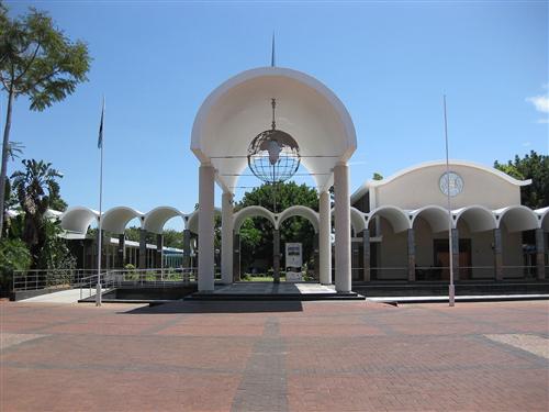
The Parliament Buildings of Botswana, Gaborone.
Source:Iulus Ascanius 2009
( click to enlarge )
Lesotho
The gruesome battles initiated by Shaka, the Zulu leader, collectively referred to as the mfecane (“the crushing”) by the Nguni people and difequane (“the scattering”) by the Basotho and Batswana people, drove many groups to take refuge outside of their homelands.
The area known as Basutoland (or Basotholand) was inhabited by San people until the sixteenth century when Bantu-speaking herders began to enter the area. In the early nineteenth century Moshoeshoe I assembled tribes and thousands of refugees that had been scattered by inter-African wars and brought the country together under one leader. Between 1856 and 1868 Basutoland was caught up in the Anglo-Boer conflict. King Moshoeshoe I turned to Queen Victoria for help and in 1868 the country was placed under crown protection. Nearly a century later in 1966, Basutoland gained independence from the U.K. and became the Kingdom of Lesotho. The Basuto National Party held power for the first two decades with King Moshoeshoe II the official monarch.
Constantine Bereng Seeiso was the paramount chief of Lesotho when the country gained independence in 1966 and went on to be better known as King Moshoeshoe II reigning from independence in 1966 until his death in 1996. King Letsie III (King Moshoeshoe’s son) is the present Chief of State and holds a ceremonial role while the Prime Minister, Pakalitha Mosisili, has executive authority. The Lesotho Congress for Democracy (LCD) controls a majority government with the All BaSotho Congress (ABC), the National Independent Party, and the Lesotho Workers Party among nine opposition parties.
The Basotho have a patriarchal society and all men have to pay a bride price or Traditional authority is still firmly exercised through a system of chieftaincy extending from the paramount chief (king) and his court, down through senior chiefs and sub-chiefs, to local headmen and sub-headmen. All Basotho belong to a clan and members share a name that links them with a specific animal totem or an ancestor. Lesotho is one of the last standing Monarchies in Africa.
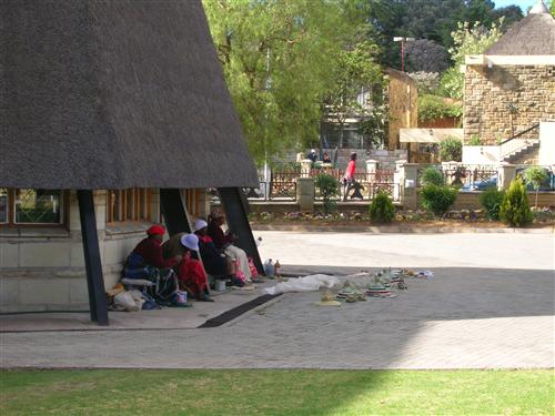
Basket-weaving at the tourist centre in the city of Maseru.
Source:Hatfield 2008
( click to enlarge )
Namibia
Historically referred to as South West Africa, Namibia remained largely unexplored and sparsely populated until the mid-nineteenth century when the ivory trade, explorers, prospectors and missionaries began to cross its borders. In 1884 the country was colonised by Germany after negotiations between the United Kingdom and Germany.
Diamonds were discovered in Lüderitz in 1908 in what was then referred to as German South West Africa drawing international attention and people to the country.
The Ovambo people make up the majority of the population and typically work as subsistence farmers in the north along with the Kavango and Caprivi peoples. The Nama, Damara and Herero are primarily situated in central Namibia although industrialization has seen the migration of these people within the country.
The Nama are the main ethnic group living along the Orange-Senqu River which delineates its southern border with South Africa. The Nama traditionally maintain a pastoral way of life, tending flocks of goats and sheep, gathering firewood and collecting wild honey, but are not fully nomadic, as they gather in settlements where they erect portable huts. The Nama have much in common with the San. They share the same linguistic roots and features, and have light skin and a small delicate frame. The Nama also share a common language with the Damara people. One of the first leaders of the liberation struggle in Namibia was Hendrik Witbooi. Witbooi, a cultural hero in Namibia, led an underground movement to harass the occupying German colonials . Today Hendrik Witbooi's face can be found on all Namibian banknotes.
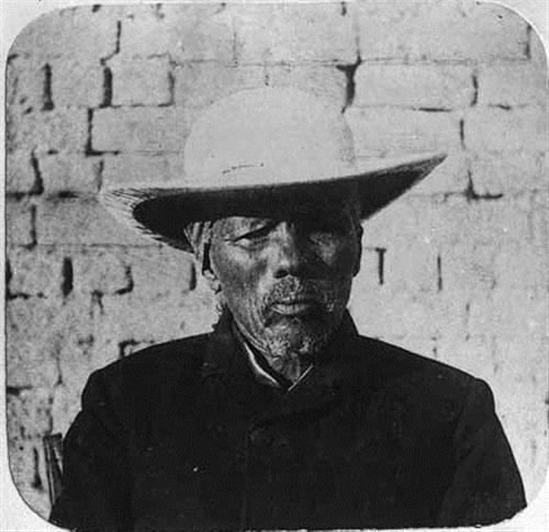
Henrik Witbooi.
Source:Dove-Sammlung 1892
( click to enlarge )
The San and the Khoi peoples were the earliest known inhabitants of South Africa; though it is believed that early humans had inhabited the country more than 100 000 years prior. The Bantu-speaking people arrived several hundred years prior to the first Europeans.
South Africa was discovered by Portuguese seafarers; but Dutch traders were the first Europeans to establish a stop at Cape of Good Hope on the spice trade route from the Netherlands to the Far East in 1652. The British seized the Cape of Good Hope in 1806 prompting the Dutch (known as the Boers) to extend their territory to the North.
The discovery of gold and diamonds in the late 19th century caused a sudden spur in wealth and much maltreatment of the native inhabitants. There was a further push on colonial expansion; in 1897 the British defeated the Zulu and incorporated Zululand into Natal. South Africa’s further the country’s history is marked by wars and apartheid; but now a politically stable country has emerged; a country with great cultural diversity.
One great achievement to this diversity is the fact that all eleven of its official languages are recognized by the constitution: Ndebele, IsiXhosa, IsiZulu, Sepedi, Sesotho, Setswana, SiSswati, Venda, Xitsonga, Afrikaans and English. Apart from English, IsiZulu, Sesotho, Setswana and Afrikaans are most frequently spoken. . Afrikaans is spoken mainly by the white farmers and the so-called Coloured population, who make up the biggest population group in the western basin, in the Northern Cape Province.
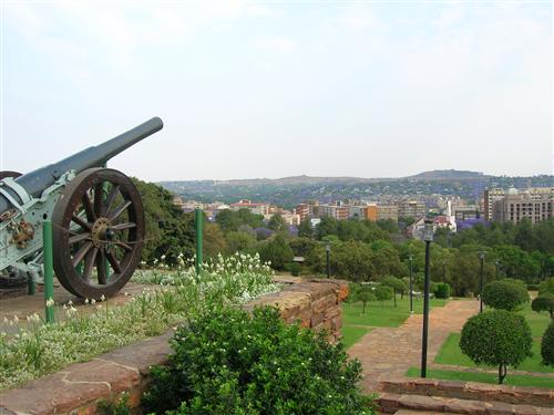
The city of Pretoria, as seen from the Union Buildings.
Source:Hatfield 2008
( click to enlarge )
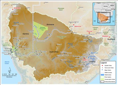
The basin states of the Orange-Senqu River basin.
Source:Hatfield 2009
( click to enlarge )
