
Maps are for display purposes only and must not be used for navigation
« prev Page 4 of 4
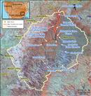
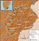 Distribution of small-scale water supply schemes in Lesotho. Source:Hatfield 2009 ( click to enlarge ) |
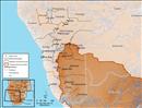
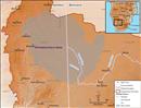 The Stampriet Artesian Basin. Source:Hatfield 2009, adapted from UNDP 2009 ( click to enlarge ) |
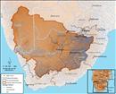
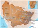 Distirbution of major irrigation schemes in the Orange-Senqu River basin. Source:Hatfield 2009 ( click to enlarge ) |
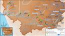
The Vanderkloof to Riet and Riet river canals, supplying water for irrigation and domestic use. Source:Hatfield 2009 ( click to enlarge ) |
 Future water infrastructure planned throughout the Orange-Senqu River basin. Source:Hatfield 2009 ( click to enlarge ) |
 Phase II of the LHWP expands the current capacity with an additional dam and transfers. Source:Hatfield 2009 ( click to enlarge ) |
 Department of Water Affairs (DWA), South Africa surface water monitoring sites in the Orange-Senqu River basin. Source:DWA South Africa 2009 ( click to enlarge ) |
 Lesotho. Source:Hatfield 2009 ( click to enlarge ) |
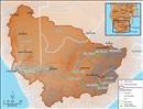
 Namibia. Source:Hatfield 2009 ( click to enlarge ) |
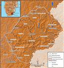
 South Africa. Source:Hatfield 2009 ( click to enlarge ) |
« prev Page 4 of 4