
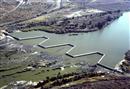
 Douglas Weir on the lower Vaal River, where water is transfered to support irrigation in the area around Douglas. Source:DWAF South Africa 2009 ( click to enlarge ) |
 Mohale dam is a rock-fill dam constructed on the Senqunyane River that comprises the major component of Lesotho Highlands Phase 1B. Source:Lesotho Highland Development Authority 2006 ( click to enlarge ) |
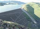 Mohale Dam is a rock-fill dam located on the Senquyane River in Lesotho. Source:McKenzie 2004 ( click to enlarge ) |
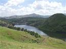 Muela Dam, located in the North of Lesotho, above the Muela Power Station. Source:Lesotho Water Commission 2009 ( click to enlarge ) |
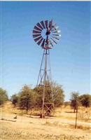
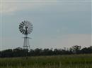
 A windpump in southern Africa, a common sight in a region dependent on groundwater. Source:Kirchner 2008 ( click to enlarge ) |
 Groundwater is the primary source of water in Botswana in the Orange-Senqu River basin. Source:DWA Botswana 2001 ( click to enlarge ) |
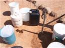
 3 300 groundwater wells serve the rural population. Source:Hatfield 2008 ( click to enlarge ) |
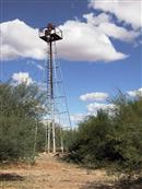 An artesian borehole located on the Stampriet Artesian Aquifer, one of the largest sources of groundwater in southern Namibia. Source:Kirchner 2008 ( click to enlarge ) |
 Groundwater supplies a large proportion of available water in the Orange-Senqu River basin. Source:Kruchem 2008 ( click to enlarge ) |
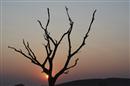 Climate change may be responsible for increased frequency and intensity of drought in the region. Source:©iStockphoto/Marchetti 2007 ( click to enlarge ) |
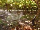 Irrigation is important to sustain vineyards in Aussenkehr, Namibia. Source:DRFN 2006 ( click to enlarge ) |
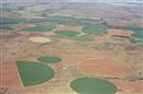 Centre pivot irrigation along the Lower Orange River. Source:Pyke 2008 ( click to enlarge ) |
 The proposed location for the Vioolsdrift Dam, on the Lower Orange River. Source:McKenzie 1998 ( click to enlarge ) |
 Clean water and its importance to meet daily needs can be taken for granted. Source:DWAF South Africa 2000 ( click to enlarge ) |
 A pre-paid water tap in Gobabis, Namibia. Source:DRFN 2005 ( click to enlarge ) |
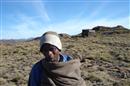
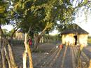 Rural village in Botswana. Source:Garner 2009 ( click to enlarge ) |
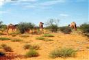 The arid landscape of southern Botswana. Source:Department of Water Affairs Botswana 2001 ( click to enlarge ) |
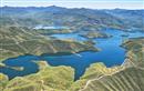
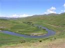 Maletsunyane River - one of the many sources of water that will be included in the accounts. Source:Lesotho Water Commission 2009 ( click to enlarge ) |
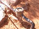 A conventional water meter in rural Namibia. Source:DRFN 2006 ( click to enlarge ) |
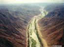
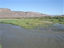 The Lower Orange River in Namibia. Source:Shilomboleni 2007 ( click to enlarge ) |