| Name | Last modified | Size | Description | |
|---|---|---|---|---|
| Parent Directory | - | |||
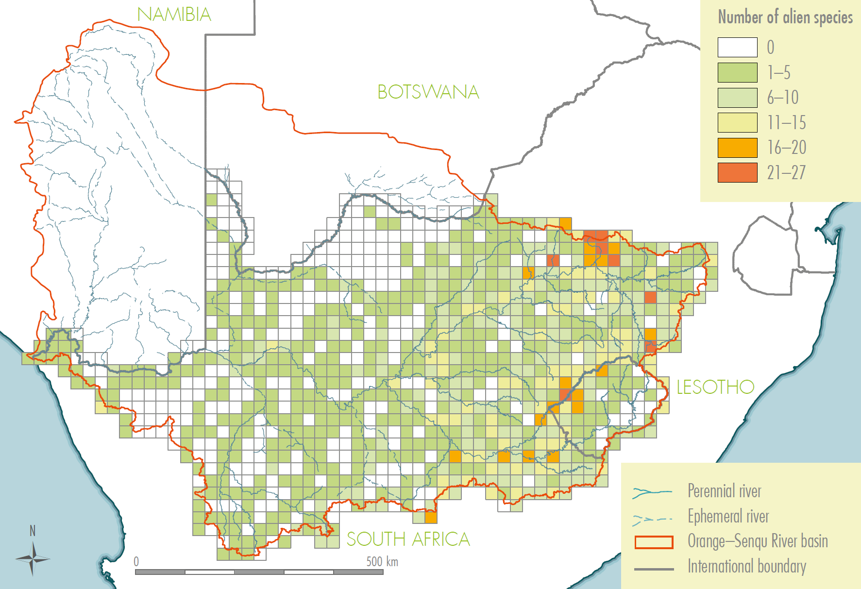
| Alien.png | 2014-01-24 15:19 | 293K | ||
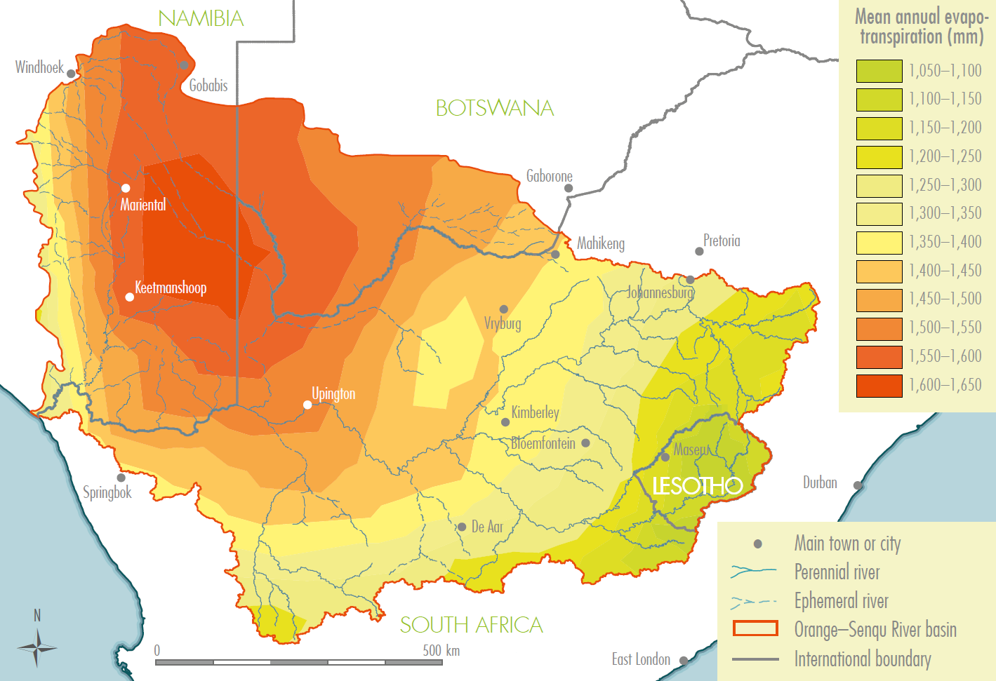
| Evap.png | 2014-01-15 02:00 | 246K | ||
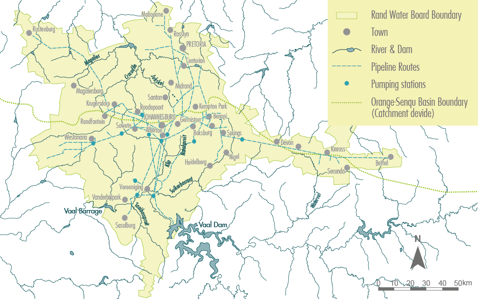
| F 2.6 Rand water sup..> | 2014-01-15 01:12 | 205K | ||
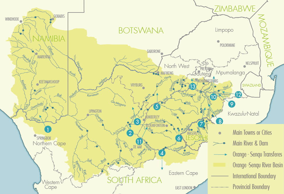
| F 2.10 Transfers in ..> | 2014-01-15 01:13 | 241K | ||
| F 2.10 Water Require..> | 2014-01-15 01:13 | 206K | ||
| Fig 4.5-01.png | 2014-01-15 01:13 | 55K | ||
| Geological map of Ba..> | 2014-01-15 01:13 | 508K | ||
| Main Biomes-01.png | 2014-01-15 01:15 | 871K | ||
| Main Biomes Lesotho ..> | 2014-01-15 01:14 | 513K | ||
| Main Biomes Upper ca..> | 2014-01-15 01:15 | 592K | ||
| Major Aquifers-01.png | 2014-01-15 01:15 | 240K | ||
| Mean annual recharge..> | 2014-01-15 01:15 | 266K | ||
| Rain.png | 2014-01-15 02:01 | 231K | ||
| Sediment load-01.png | 2014-01-15 01:15 | 243K | ||
| Soil map Colour-01.png | 2014-01-15 01:15 | 431K | ||
| cc.png | 2014-01-15 02:00 | 234K | ||
| geo.png | 2014-01-15 02:00 | 517K | ||
| landcover.png | 2014-01-15 02:00 | 452K | ||
| pop.png | 2014-01-15 02:00 | 297K | ||