|
Hydrology: Surface Water:
Flooding |
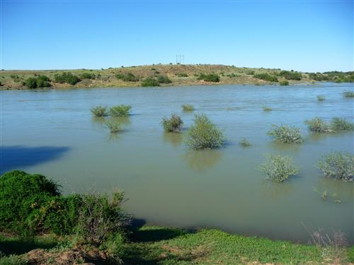
A flood event is usually caused by heavy rainfall occuring on all or part of a river basin. Flood events are created when rain falls at a rate faster than water is absorbed by the soil, resulting in surface runoff. When runoff enters streams and rivers, streamflow is increased, sending a pulse of water down the river. When rainfall persists, the amount of water flowing down a river continues to increase, eventually exceedintg the capacity of the river channel, overflowing the river bank and spreading across the floodplain (known as bankfull discharge). As floodwaters flow downstream, it recedes quickly, as water in the floodplain is absorbed or drained back into the river channel.
Natural variability of riverflow is a part of the hydrological regime that creates and maintains healthy riverine ecosystems (Poff et al. 2007). Large floods (also known as reset events) can drive many processes that shape a river system and lead to renewal of the landscape. They bring nutrients to the soil, thatonce the flood waters have receded, leaving behind more productive agricultural land. Furthermore, groundwater resources are recharged by inundation and saturation of the soil.
Extreme low-flow periods are also important and can impact species selection. This is especially true in southern Africa where prolonged drought and erratic rainfall stresses individual species and whole ecosystems. Plants and animals of a river system are generally adapted to its hydrologic regime, and their growth and migration patterns are closely linked to availability and quality of water.
In the Orange-Senqu River basin, flooding can result in direct and indirect negative impacts. This is because areas prone to flooding are either human settlements or irrigated farmlands. Below is a summary of areas threatened by flooding within each of the basin states.
Botswana
Human settlements or irrigation farmland are not threatened as a result of flooding in the Orange-Senqu River basin.
Lesotho
Most human settlements are located in the lowlands, prone to frequent flooding. Flooding in the Orange-Senqu River Basin causes occasional loss of life and loss of agricultural production.
Namibia
The region downstream of the Hardap Dam (Mariental town, the road network and the Hardap irrigation scheme) and the irrigation areas along the banks of the Orange River are prone to frequent flooding.
South Africa
Emergency Preparedness Plans are required for areas downstream all dams that pose potential safety risks (many are still outstanding). These Plans are required to include inundation maps.
Flood risks in various sections of the Orange-Senqu River basin are outlined below:
Vaal River System
Towns located downstream of Grootdraai Dam and Vaal Dam are prone to flooding as are most of the formal irrigation schemes in these areas.
Upper Orange System (excluding Lesotho)
Most irrigation schemes are located on the river banks, and are therefore, prone to flooding. The only human settlements located near rivers in this area are Aliwal North, Hopetown and Wepener.
Lower Orange River System
Upington, Prieska, Keimoes and Kakamas settlements, and most of the formal irrigation schemes along the banks of the Lower Orange River are prone to flooding.
![]()