|
Geography: Geomorphology:
Relief |
Relief is the range of topographic variation within a given area (Pidwirny 2008), and is usually measured in differences and variations in elevation, and includes reference to the angle of slopes and the shape of landforms.
Relief in the Orange-Senqu River Basin
The upper reaches of the Orange- Senqu River Basin are dominated by steep topography, especially in the Lesotho Highlands. From the border with Lesotho the relief is fairly even and undulating, with an incised river channel in portions of the downstream reaches (Augrabies falls etc). The lower river is flat with a wide flood plain. The Molopo, Nossob and Auob River channels run through wide flood plains that cross relatively level, undulating topography. The Fish River is characterised by very steeply incised valleys, as seen in the image below.
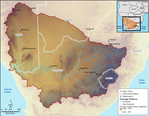
The highest point in the basin is at the source of the river in Lesotho highlands (Thabana Ntlenyana) at 3 482 m above sea-level.
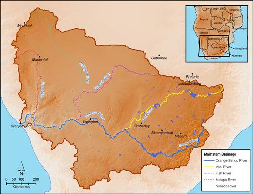
River Profiles for the Orange-Senqu River Basin
One useful perspective on relief is a river profile. It provides a snap-shot of the geomorphology of the river that can help with understanding stream flow and the overall regime of the river. River profiles are essentially cross-sectional representations of the path of a river, usually taken from source to mouth.
The following illustrations shows the elevation profiles for various segments of the Orange-Senqu River basin. Each graphic shows the location of the major dams, towns and cities, points of interest and confluences, located along the rivers.
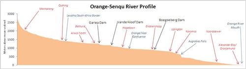
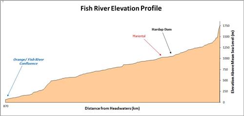
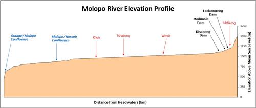
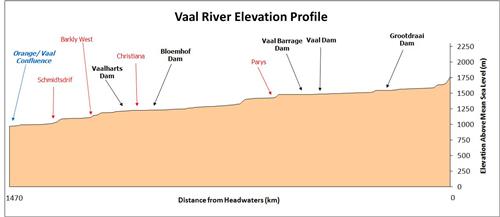
These river profiles were developed using a digital elevation model (DEM) obtained from the Space Shuttle Radar Topography Mission (SRTM) and a 1:500 000 scale river GIS dataset provided by the Department of Water Affairs (DWA), South Africa.
![]()