|
Ecology and Biodiversity: Biodiversity:
Biodiversity in the Orange-Senqu Basin |
The Orange River basin is an extraordinarily geographically and biologically diverse system originating in the highest point in southern Africa at 3 482 m above mean sea-level, and flowing westwards for over 2 300 km to its mouth at the Atlantic Ocean. Its upper catchment falls within both the rainiest and coldest parts of southern Africa, while its lower reaches cross the driest and hottest areas of the region.
From an ecological perspective, the basin system is one of the most modified in southern Africa. The amount of water actually reaching the Orange River Mouth is less than 50% of the natural runoff (11 600 Mm³/a: ORASECOM 2007f). The is due to extensive water use in the Vaal River basin, mainly for domestic and industrial purposes including mining and irrigation, as well as transfers out of the river. The transfers are for use both inside and outside the basin in the lower sections of the Orange. A number of dams have been constructed in the catchment, and abstraction and transfer systems have marked effects on the biodiversity of the Orange River system.
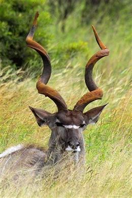
To determine to what extent biodiversity is being affected in the basin, biodiversity indicators in the form of endemic flora and fauna are monitored. The most common biodiversity indicators of the basin are summarised in the table below (WRI 2008), based on information obtained from SADC, the International Union for the Conservation of Nature (IUCN), the World Resource Institute (WRI) and Ramsar.
Table: Biodiversity indicators and distribution in the Orange-Senqu basin.
|
Number of Fish Species |
24 |
|
Number of Fish Endemics |
70 |
|
Number of Amphibian Species |
42 |
|
Number of Ramsar Sites |
5 |
|
Number of Wetland-Dependent IBAs |
7 |
|
Number of Endemic Bird Areas |
2 |
|
Percent Protected Area |
4 |
Biodiversity Hotspots
Conservation International maintains a list of internationally recognised biodiversity hotspots. The distribution of these hotspot areas is show in the map below. As can be seen from this map, the three primary hotspots in the region are:
- Cape Floristic Region
- Maputaland-Pondoland Albany Region
- Succulent Karoo
All of these hotspots are found along the southern and western fringes of the Orange-Senqu River basin, with only minimal coverage of Maputaland-Pondoland Albany Region and Succulent Karoo within the basin itself.
The map below shows the distribution of these hotspot areas, along with the locations of Ramsar sites, in relation to the Orange-Senqu River basin.
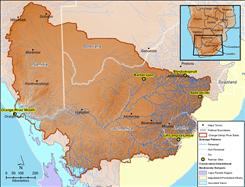 Biodiversity Hotspots and Ramsar sites in the Orange-Senqu River basin. Source:Hatfield 2009, after Conservation International 2009; Ramsar 2009 ( click to enlarge ) |
Protected Areas in the Orange-Senqu River basin Source:Hatfield 2009, adapted from UNDP/GEF 2008 and Atlas of Namibia 2002 ( click to enlarge ) |
![]()